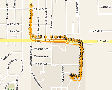
Occasionally, while tracking the movements of an Employee or Device, Map Suite GPS Tracking Server may record a large number of location points that are very close together. If all of these points are displayed on the map at once, the result is a cluttered route that becomes difficult to read, as in the screenshot below.
Cluttered route with many location points
Map Suite GPS Tracking Server can be configured to consolidate some of these points and display a cleaner, easier-to-read route instead. You can do this by changing the values of the Max Consolidation Radius and Temporal Segment Boundary settings in the User Settings Editor.
To access the User Settings Editor, click the  link on the right side of the toolbar, from any screen in the system.
When the User Settings Editor appears, click the  tab to access the Max Consolidation Radius and Temporal Segment Boundary settings.
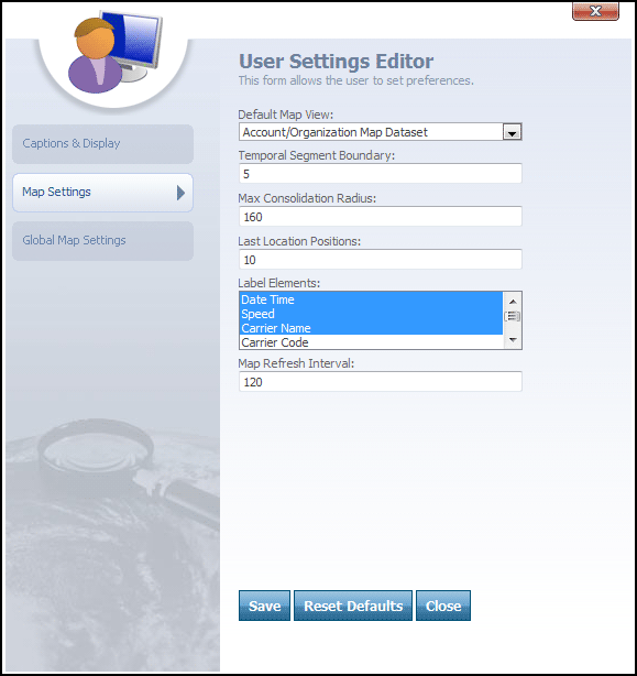
User Settings Editor -> Map Settings tab
Overview
The goal of the Max Consolidation Radius and Temporal Segment Boundary settings is to prevent the map from becoming too cluttered with location points. By comparing the distance and time of the location points, some of the points can be removed from the map, thus making the map easier to read.
Map Suite GPS Tracking Server uses the Max Consolidation Radius and Temporal Segment Boundary values to determine if a point is significant enough to display on the map. If you have a lot of points all in a very small area, all posted within a short amount of time, the value of each of those individual points is not very high. But if you have a point that appears far away from the other points in either time or distance, the value of that location is much higher and thus needs to be displayed on the map.
What The Options Mean
How They Work Together
Max Consolidation Radius Conditions
If the distance between two points is greater than the Max Consolidation Radius, then the last point will be drawn on the map regardless of any other settings.
If the distance between two points is less than the Max Consolidation Radius, then the Temporal Segment Boundary value will determine if the last point will be shown, as described below.
Temporal Segment Boundary Conditions
If the time span between the points is less than the Temporal Segment Boundary value, then the last point will not be shown on the map.
If the time span between the points is greater than the Temporal Segment Boundary value, then the last point will be shown on the map.
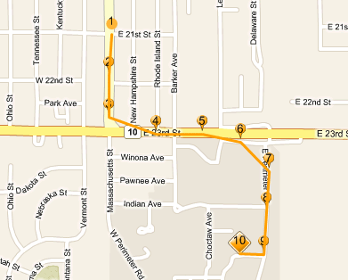
The same Session as the previous figure, but with these settings applied:
- Max Consolidation Radius: 160
- Temporal Segment Boundary: 5
Note: Although using these settings may reduce the number of points that are visible on your map, Map Suite GPS Tracking Server still stores every discrete location in its database -- even the ones that are not displayed. You can find a complete list of all tracked locations in a Session, including X and Y coordinates, on the Locations detail tab.
More:
Adding an Existing Geofence to a Department
Assigning an In Geofence for an Employee
Assigning an Out Geofence for an Employee
Changing the Map’s Auto-Refresh Frequency
Customizing the Size of the Map
Manually Refreshing the Map Data